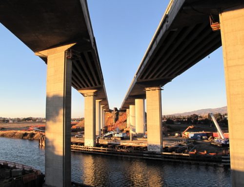
The Sonoma County Board of Supervisors on Tuesday agreed to add about 42 miles of roads to the county’s list of priority roads that will receive enough maintenance to keep them in good shape. That’s on top of the 155.9 miles of roads that the board made a priority last year.
That’s a total of 198 miles out of the 1,382.8 miles that the county is responsible for. There’s also 20.8 miles of roads that the county roads department wants the board to add to the priority list, but there’s not enough funds for that now.
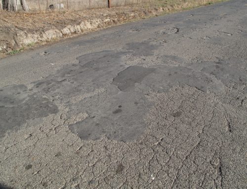
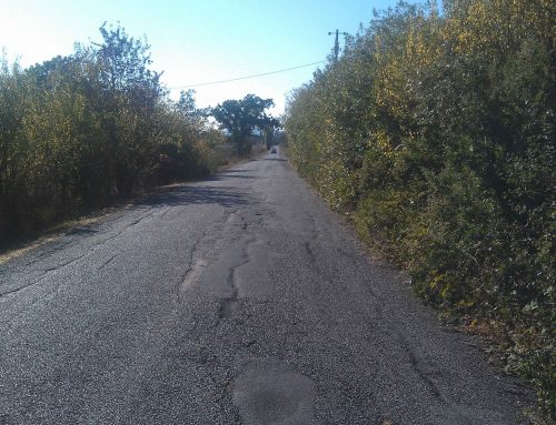
All this means that the remaining 1,164 miles of county roads will get only basic maintenance.
In a report to the board, the roads department said, “The majority of these roads are in a failed condition requiring costly reconstruction repair. These roads will continue to deteriorate and will become increasingly more difficult and costly to keep safe. Without funding for rebuilding these roads, they will eventually deteriorate to a point in which it would be safer and less costly to pulverize and maintain in an unpaved condition.”
Here’s the list of the 42.1 miles of roads added to the priority list:
–Agua Caliente Road, from Arnold Drive to Highway 12, 0.8 miles.
–Arnold Drive, from Highway 116 eastbound offramp, 0.2 miles
–Bennett Valley Road, from Grange Road to Warm Springs Road, 5.4 miles
–Bloomfield Road, from Pleasant Hill Road to Highway 116, 1.8 miles
–Boyes Boulevard, from Arnold Drive to Highway 12, 0.9 miles
–Corby Avenue, from Hearn Avenue to Santa Rosa city limits, 0.3 miles
–Corona Road, from Petaluma city limit to just past Ormsby Lane, 0.8 miles
–Corona Road, from Petaluma Boulevard North to Petaluma city limits, 0.1 miles
–D Street, from Marin County line to Petaluma city limits, 3 miles
–Dutton Avenue, from West Robles to Santa Rosa city limits, 0.2 miles
–Dutton Avenue, from Hearn Avenue to Santa Rosa city limits, 0.7 miles
–East Napa Street, from Sonoma city limits to Eighth Street East, 0.3 miles
–Ely Road, from Old Redwood Highway to Corona Road, 1.2 miles
–Fifth Street West, from Leveroni Road to Sonoma city limits, 0.3 miles
–Geyserville Avenue, from Banti Lane to Highway 128, 1 mile
–High School Road, from Sebastopol city limits to Occidental Road, 1.3 miles
–Llano Road, from Todd Road to Highway 12, 2.3 miles
–Madrone Road, from Arnold Drive to Highway 12, 0.9 miles
–Mecham Road, from Pepper Road to Stony Point Road, 1.9 miles
–Moorland Avenue, from Todd Road to Bellvue Avenue, 1 mile
–Olivet Road, from Guerneville Road to River Road, 2.3 miles
–Railroad Avenue, from Verano Avenue to Boyes Boulevard, 0.8 miles
–Roberts Lake Road, from Rohnert Park city limits to Santa Rosa Avenue, 0.2 miles
–Skillman Lane, from Bodega Highway to Petaluma Boulevard North, 2.6 miles
–Standish Avenue, Todd Roa to Santa Rosa city limits, 0.5 miles
–Todd Road, from Phillips Avenue to Stony Point Road, 0.4 miles
–Valley Ford Road, from Highway 1 to Tomales Road, 8.2 miles
–Verano Avenue, from Highway 12 to Sonoma city limits, 0.4 miles
–Warm Springs Road, from Arnold Drive to Bennett Valley Road, 2.4 miles
——————
Follow the Road Warrior on Twitter via @PDRoadWarrior